 |
 |
Providing Two Way Radio Communications Call Us Today (609) 888-1234 |
|
MOTOTRBO - StreetTrek StreetTrek™ is a software solution for effective real-time tracking of vehicles, people or assets. StreetTrek utilizes popular GSM/GPRS hardware, including Enfora® MT-GL modems, and GPS-capable two-way radio models, including Motorola MOTOTRBO™ series radios. StreetTrek™ runs on its own, with no general-purpose browser like Internet Explorer involved. GPS data can be obtained from a local source or received over the Internet. Need to stay in touch with your fleet while out of the office? No problem. StreetTrek™ offers solutions that will run on a PDA or a SmartPhone with Windows Mobile 5 OS or higher. Using StreetTrek™ is simple and intuitive, with no training required. Vehicles or persons are represented by realistic-looking graphics. You can even use graphics of your own choice and/or design. Icon labels can change background color to indicate telemetry or emergency conditions. Multiple maps can be opened in separate windows. You can use dual monitors for an overview of the whole fleet on one display and follow several vehicles in separate, individually scalable maps on a second display. Users can enhance their maps with custom-labeled landmarks. StreetTrek™ Main Features:
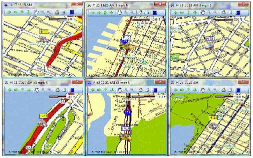 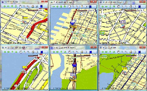 You can open multiple maps assigned to individual vehicles. These maps are scaled and resized independently from the main map and from each other. These dedicated maps never lose their vehicles. If the vehicle moves out of the current detail map boundaries, the map will automatically center around the new vehicle position. The vehicle icon is always on the detail map, even when the vehicle has moved off the main map. The number of detail windows that can be opened simultaneously is limited only by available display space. For the best results use dual monitor systems - you can keep the main map on the main display and detail maps on the secondary display. 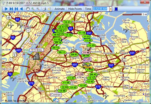 All vehicle positions are saved in a database on the server. Whenever you need to retrace a past route of a particular vehicle just click the folder button. You will be prompted to select vehicle, date and time. StreetTrek will retrieve AVL data from the server and generate a screen like the one shown here. Moving the mouse cursor over the route point will produce a balloon with the closest address match and vehicle speed. The colors of the route points represent driving conditions: green for normal; pink when speed exceeds a customer-defined threshold; yellow for customer-defined special conditions such as operating emergency lights and/or siren; and gray for parked vehicle. This provides a quick and easy overview of the vehicle's past route. A printed hard copy is only a mouse click away - the toolbar button will send the map to the printer. All data loaded onto this screen can also be viewed in a tabular printable report form that can be shown side by side with this screen via toolbar option, or directly from the main program window. StreetTrek™ Explorer powered by Google™ MapsStreetTrek™ Explorer Main Features:
StreetTrek™ Explorer Main Benefits:
|
|


